During complex incident response over a wide area, command centers can lose visibility of blue force positions, degrading Common Operating Picture (COP) for tactical coordination.
(Usage/ Concept of Operations / CONOPS):
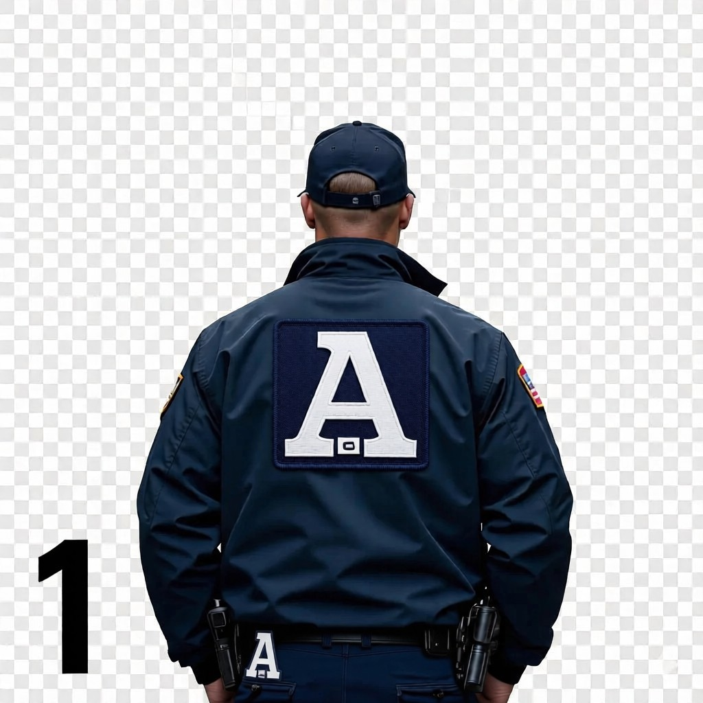
- Wear Assigned Tag: Each team member wears an assigned, lightweight visible-spectrum passive identifier (illustrated with the “A” velcro patch).
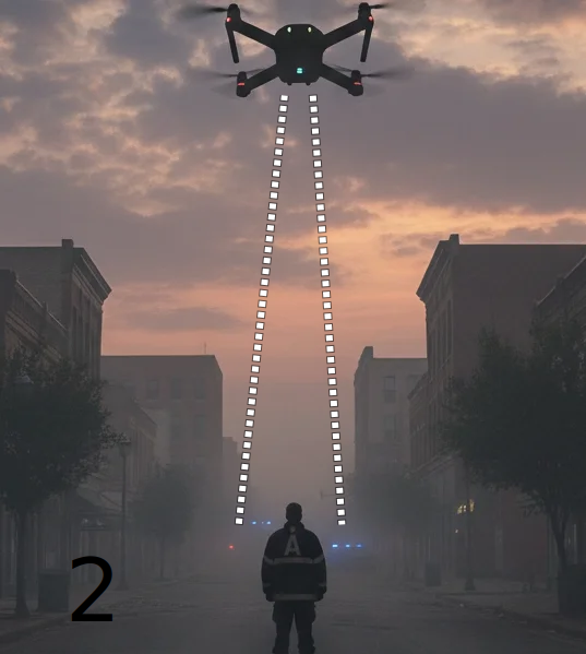
- Drone Flies the Area of Operations: The pilot flies the area of operations, edge video processing, such as a phone, enables real-time detection and processing during the response.
- Mapping/C4 Intelligence, Surveillance, and Reconnaissance: The system georeferences latitude/longitude from drone image data during the response for COP integration. Detected team member locations are displayed on an edge device map and/or transmitted to a Tactical Awareness Kit (*TAK) system or feed other ISR systems.
Benefits:
- Low RF Signature: Passive optical tracking means supports Emissions Control, with no on-body RF emissions (no “squawks”). This ensures Low Probability of Intercept / Low Probability of Detection (LPI/LPD), preventing adversarial triangulation, SIGINT tracking, or electronic warfare interference in RF constrained environments.
- Size, Weight, Power and Cost optimized: SWaP-C – minimal additional batteries and charging cycles.
- Rapid Interoperability for Ad-Hoc Teams: Generate and deploy optical identifiers on-the-fly. Suitable for multi-jurisdictional response, allowing immediate integration of disjointed agencies into a unified Blue Force Tracking network.