Few 911 Operators. Lots of Callers. Every One of Them Somewhere Different.
Real-time, risk-minimized navigation for active threats, natural disasters, and industrial incidents — routing each person around the hazard, not just around traffic.
The Problem
When a shooting, fire, or chemical release begins, the 911 system is the first thing people reach for — and the first thing to collapse under load. A single active-shooter event can generate hundreds of calls within minutes. A dispatch center may have a handful of operators on shift.
Each caller is in a different room, on a different floor, with a different set of doors, stairwells, and windows available to them. Each caller faces a different threat at a different distance with a different amount of time. Each caller needs a different answer.
No dispatch center can give it. Operators are trained to triage, calm, and collect information — not to compute a turn-by-turn safe route for large groups of people at once. So the guidance collapses to what can be said to everyone: “shelter in place.” “Get out if you can.” “Stay on the line.”
Two failures compound here.
1. The throughput bottleneck
Personalized escape guidance is a one-to-one service, and there are far more people than operators. The math does not work, no matter how many operators are staffed.
2. The threat picture never reaches them
Callers describe what they see. Those reports enter a queue. Cameras, acoustic sensors, and CAD systems hold additional fragments. That information exists in real time — but is never assembled and returned to each bystander as guidance for their specific escape options.
So people improvise. They run toward the shooter. They take the stairwell the shooter is walking toward. They exit into a line of sight they cannot see. They die not because they didn’t want to escape, but because there was no way to know which way was safer at their specific moment.
Escape Route Goals
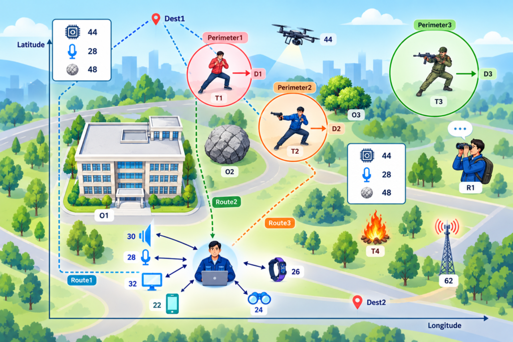
It automates the thing a 911 operator cannot do at scale: compute a personalized, risk-minimized route for every person simultaneously, and update it every few seconds as the threat moves.
For each person, the system takes their position, their mode of transportation, and their objective, and routes them against a live model of the threat environment, a model that is itself built from the very reports, sensors, and data feeds that today are throttled.
Core Capabilities
Threat-type mapping
Each hazard class — pistol, rifle, explosive, fire, chemical — carries its own danger radius, refined by context and environment.
Projected perimeters
Routing around where danger will be, using observed kinematics and physics-based propagation models.
Multi-source detection
Acoustic classification, computer vision, environmental sensors, TAK/CAD feeds, and natural-language processing of first responder and bystander reports.
Decentralized variant
A peer-to-peer embodiment with on-device routing, cryptographic trust, and no central authority required.
Adaptive output
Spoken, visual, and haptic guidance delivered to phones, wearables, heads-up displays, and speakers.